|
How to find OHP
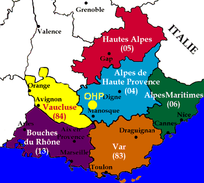
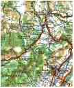
These maps, extracted from local area road maps, show the location of OHP relative to the nearest large cities (Aix-en-Provence, Marseille) and to the nearest towns (Manosque, Forcalquier). The main access roads are clearly labeled on the maps. The A51 high-speed highway from Marseille to Manosque is a toll highway between Pertuis and Manosque.
You can also look up the interactive MapBlast map around Saint-Michel l'ObservatoireThese images have been scanned from the following Michelin maps: No. 919 "France Sud" (1/1 000 000 scale) and No. 81 "Montťlimar Avignon Digne" (1/200 000 scale).
S.A.Ilovaisky Updated: 14 December 2004 |